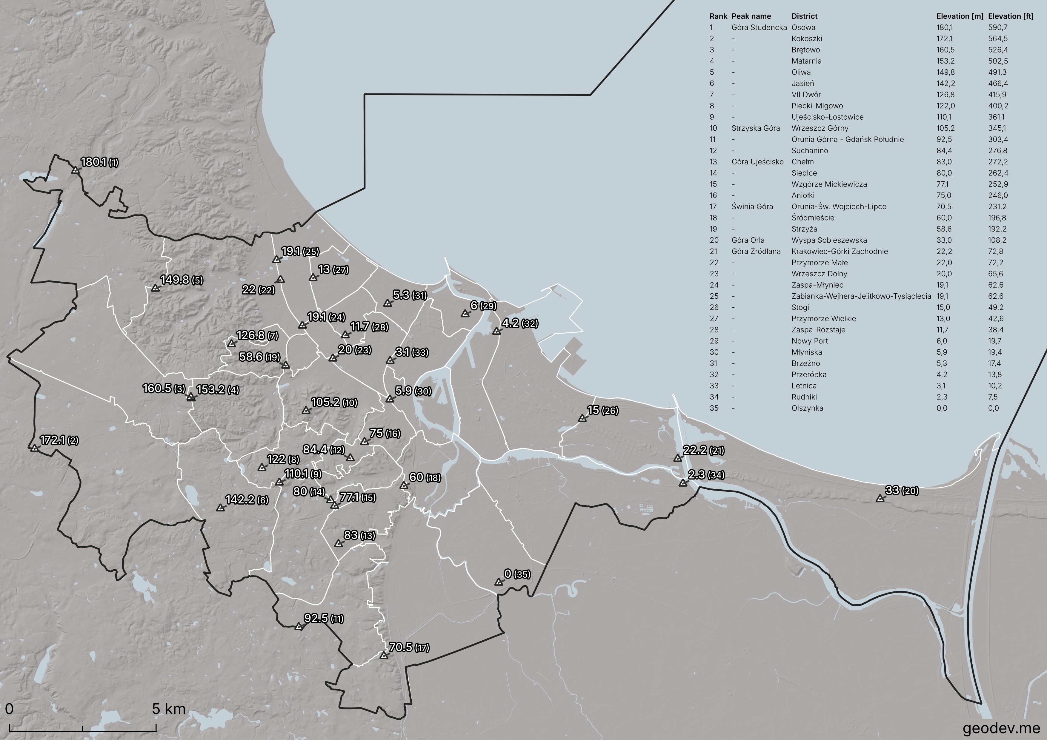
Gdańsk, a city located on the Baltic Sea, is one of the cities with lowest elevation in Poland. However, the terrain is very diverse, with elevation differences of almost 200 meters in various parts of the city.
The eastern and southern parts are located in the Żuławy Wiślane region – the only region in Poland characterized by depressions. Elevations within the administrative boundaries of Gdańsk are 0 m or just slightly above 0 m.
The western part of Gdańsk lies within the Kashubian Coast (pol. Pobrzeże Kaszubskie) and the Kashubian Lake District (pol. Pojezierze Kaszubskie). The terrain here is varied and has significant elevation differences. This varied topography is the result of the activity of the glacier, which has traversed the region several times. For more details, please refer to the Wikipedia article.
Most of the “peaks” are unnamed, which is understandable. They have never been important points from a topographical point of view and have no historical value. Seven districts have their highest points at an elevation of no more than 10 meters. Heights above 100 meters are located within 10 districts.
I marked these points based on an excellent series of articles by Tomasz Larczyński, who published them on a local portal Trojamiasto.pl (link in the Sources section). The author also used numerous archival maps and LIDAR measurements to discover the highest points. I made individual height corrections based on readings from topographic maps.
The values at the points on the map indicate the height in [m] and the position in the table.
Sources:
- Topographic map of Poland, 1: 10 000,
- https://www.trojmiasto.pl/wiadomosci/w,Korona-Trojmiasta-Najwyzsze-szczyty-dzielnic-Gdanska-Gdyni-i-Sopotu-5140.html.