Projects
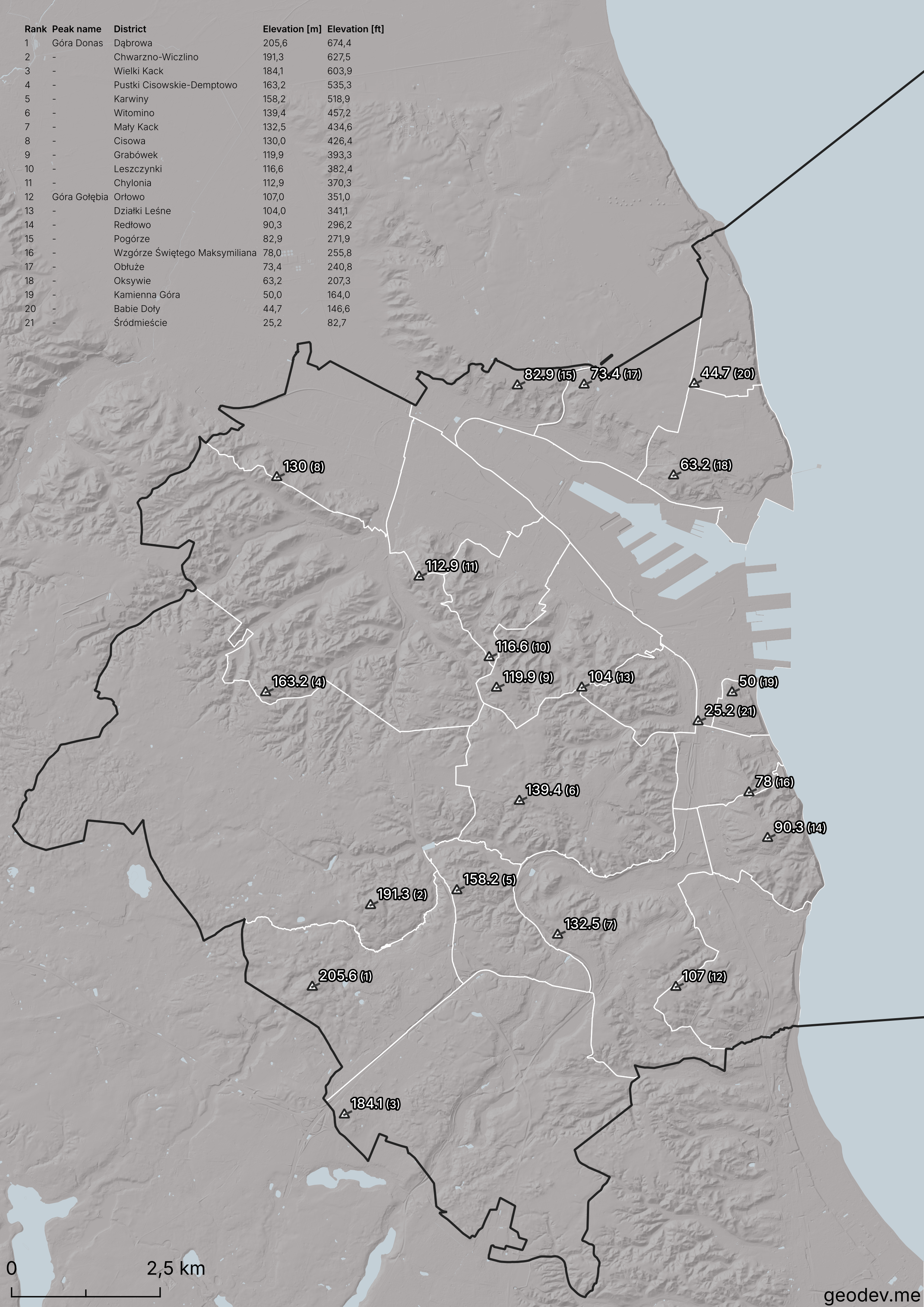
Highest points in Gdynia districts
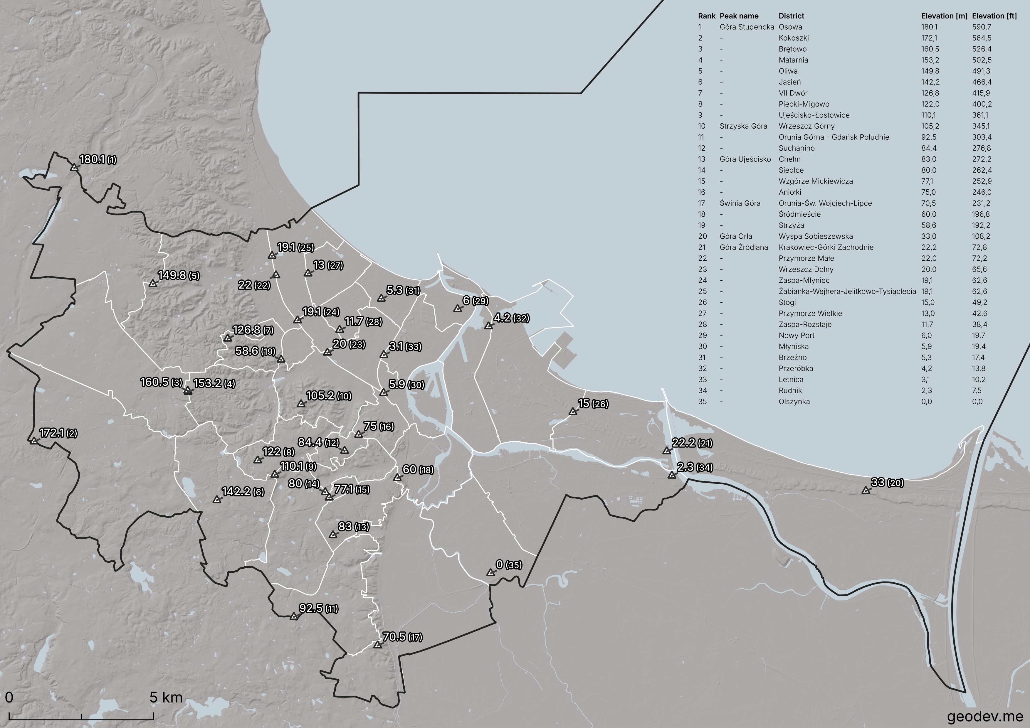
Highest points in Gdańsk districts
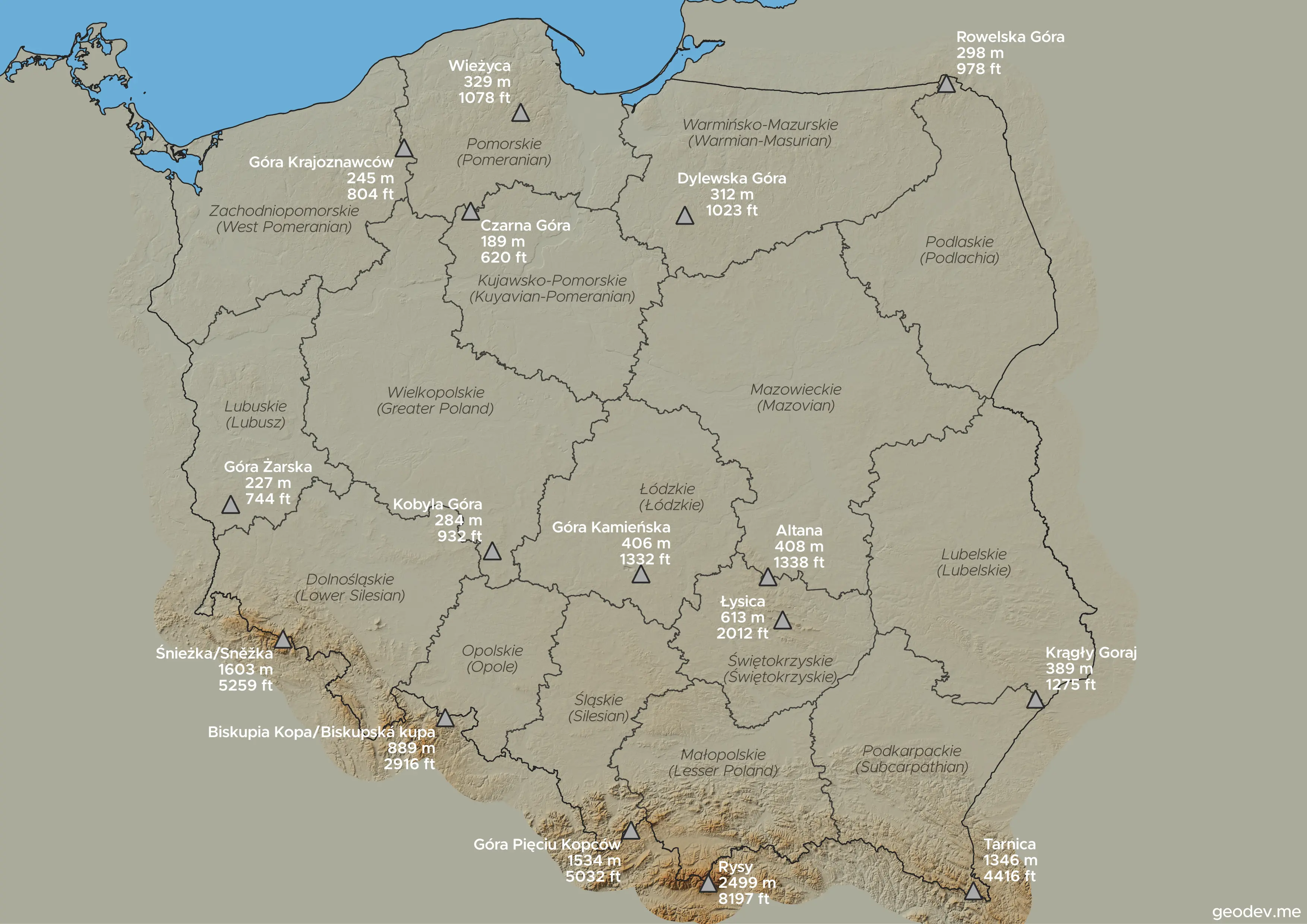
The highest point in every voivodeship in Poland
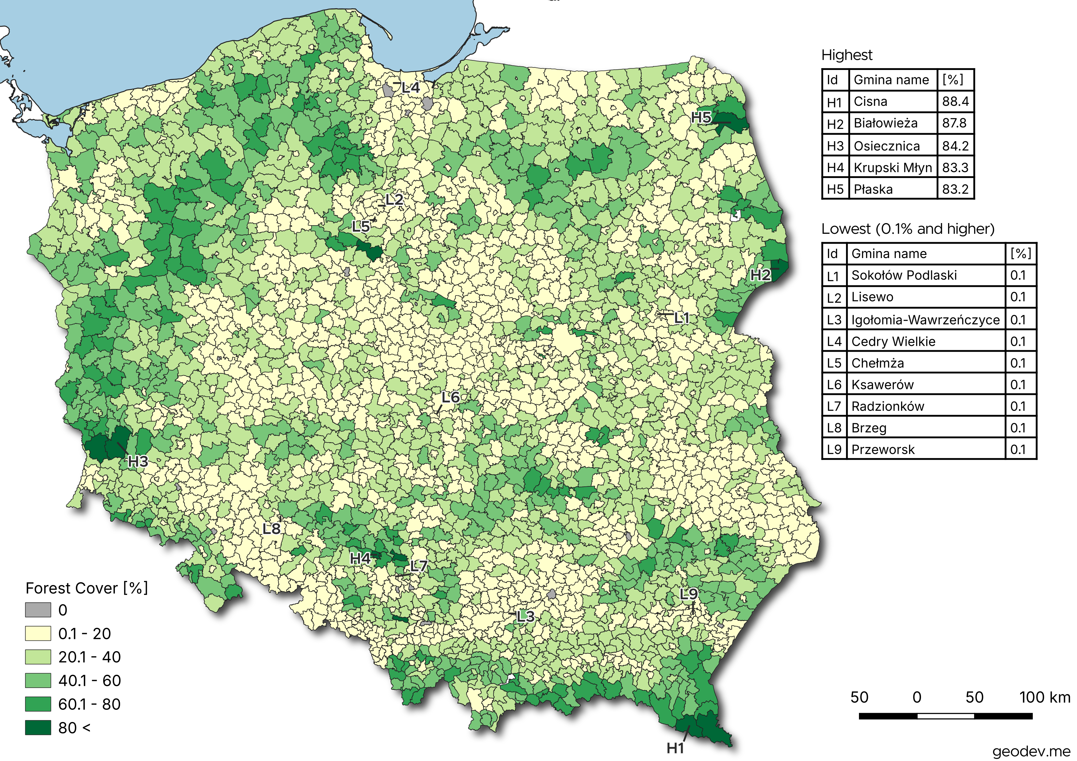
Forest cover in Poland
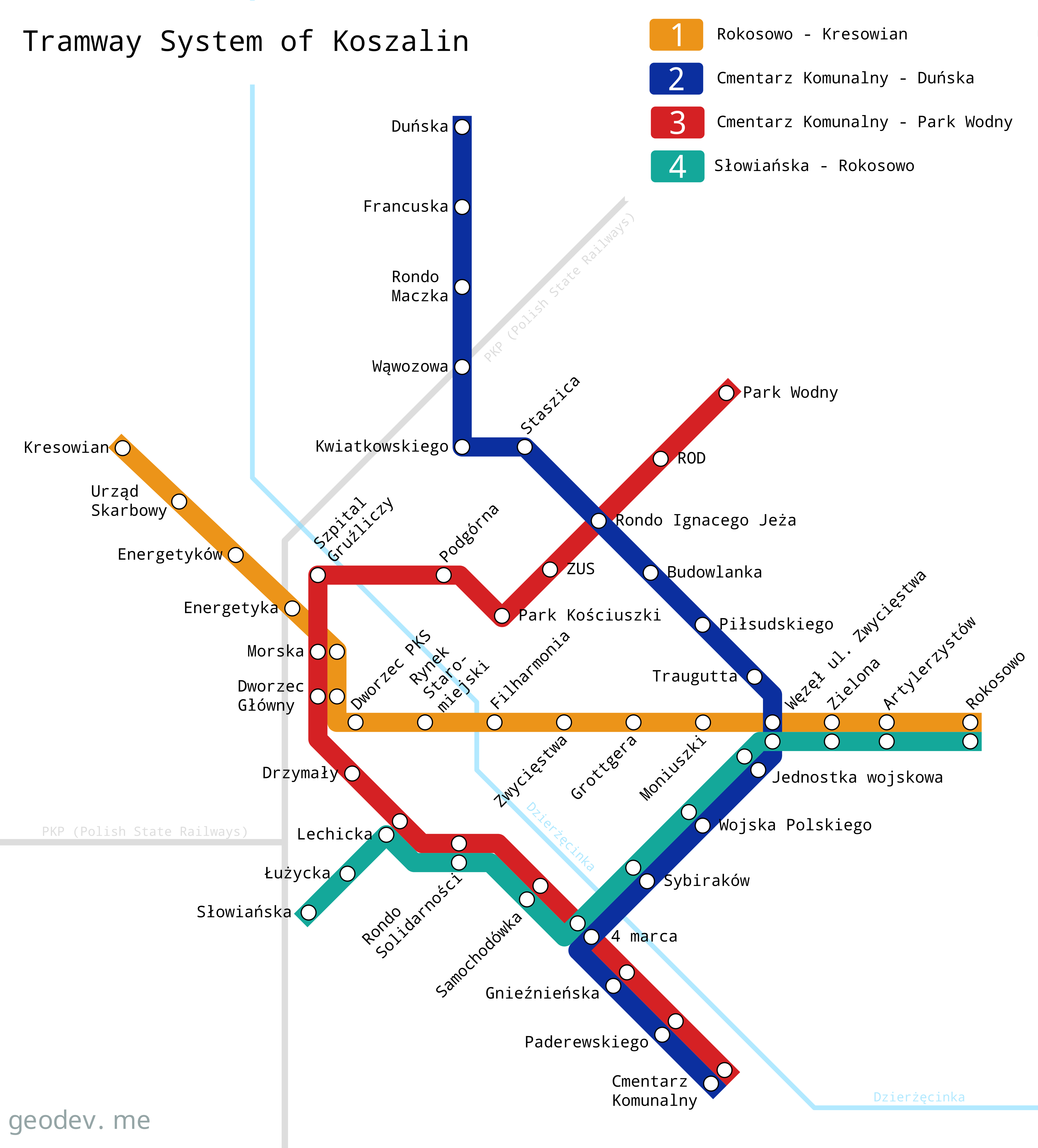
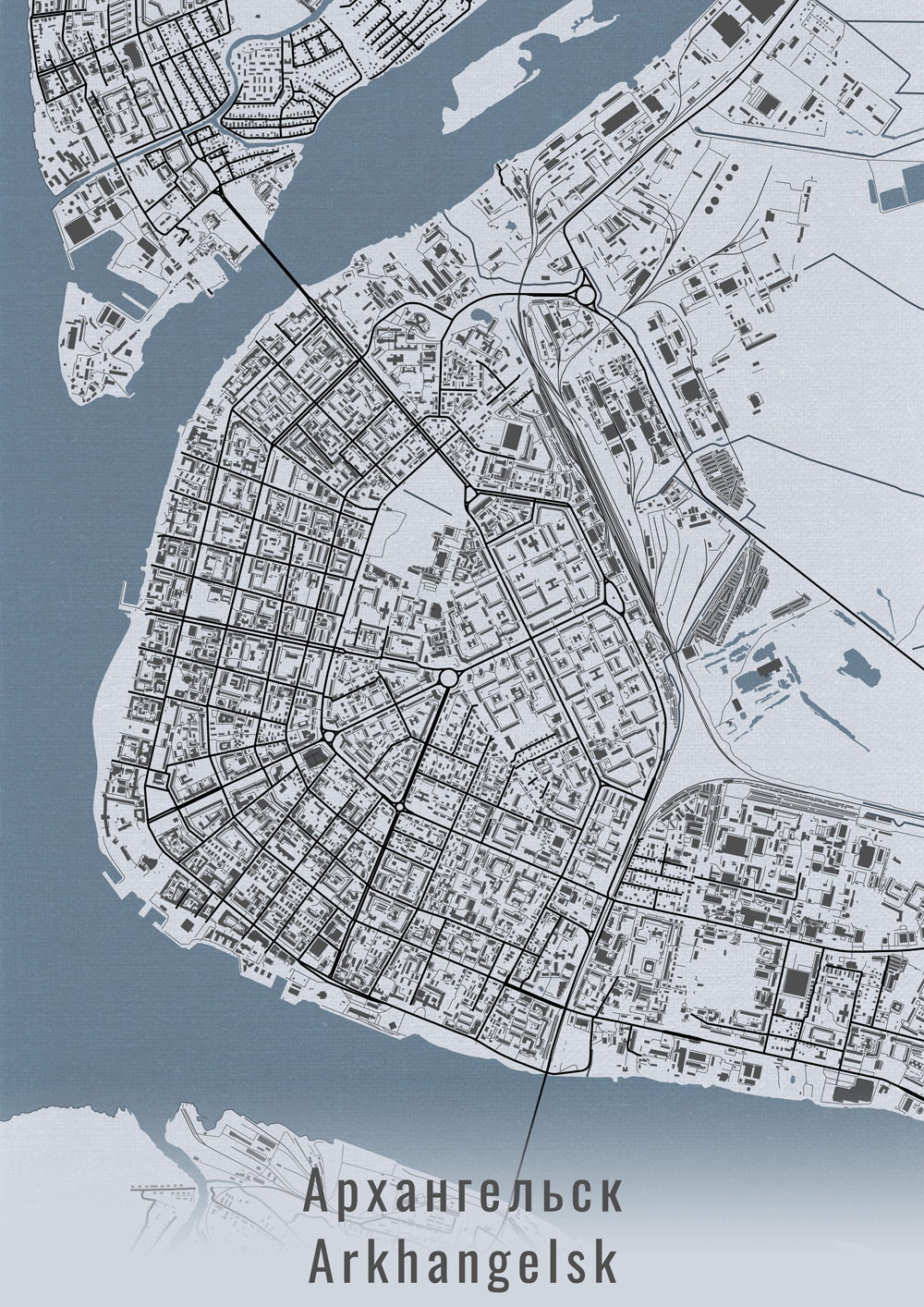
Transit Maps
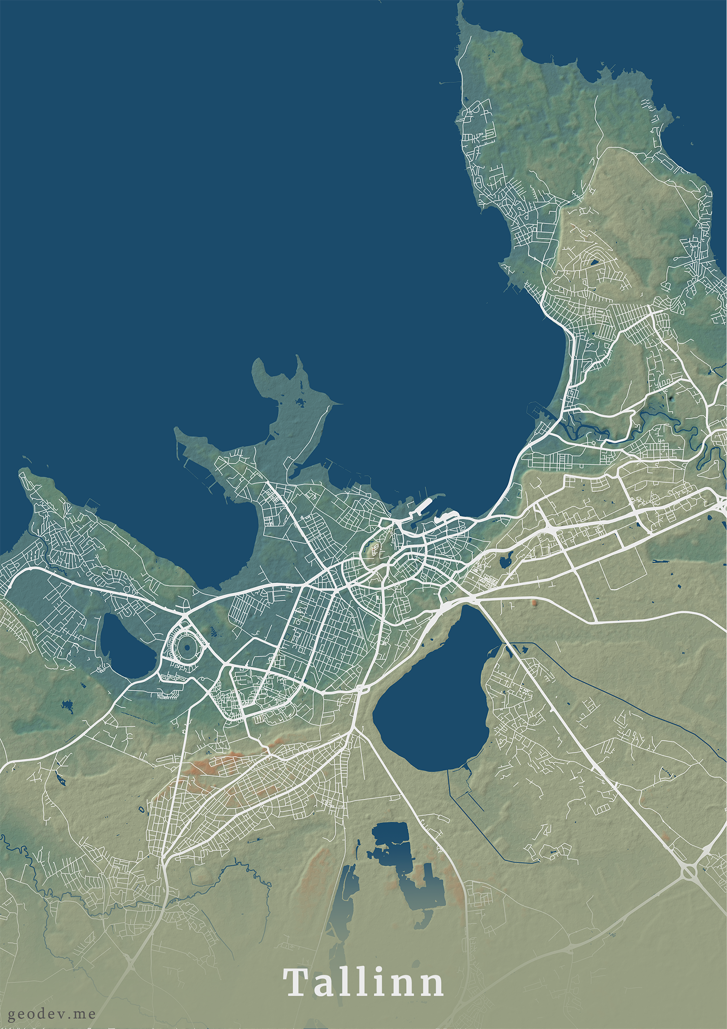
Tallinn Poster map
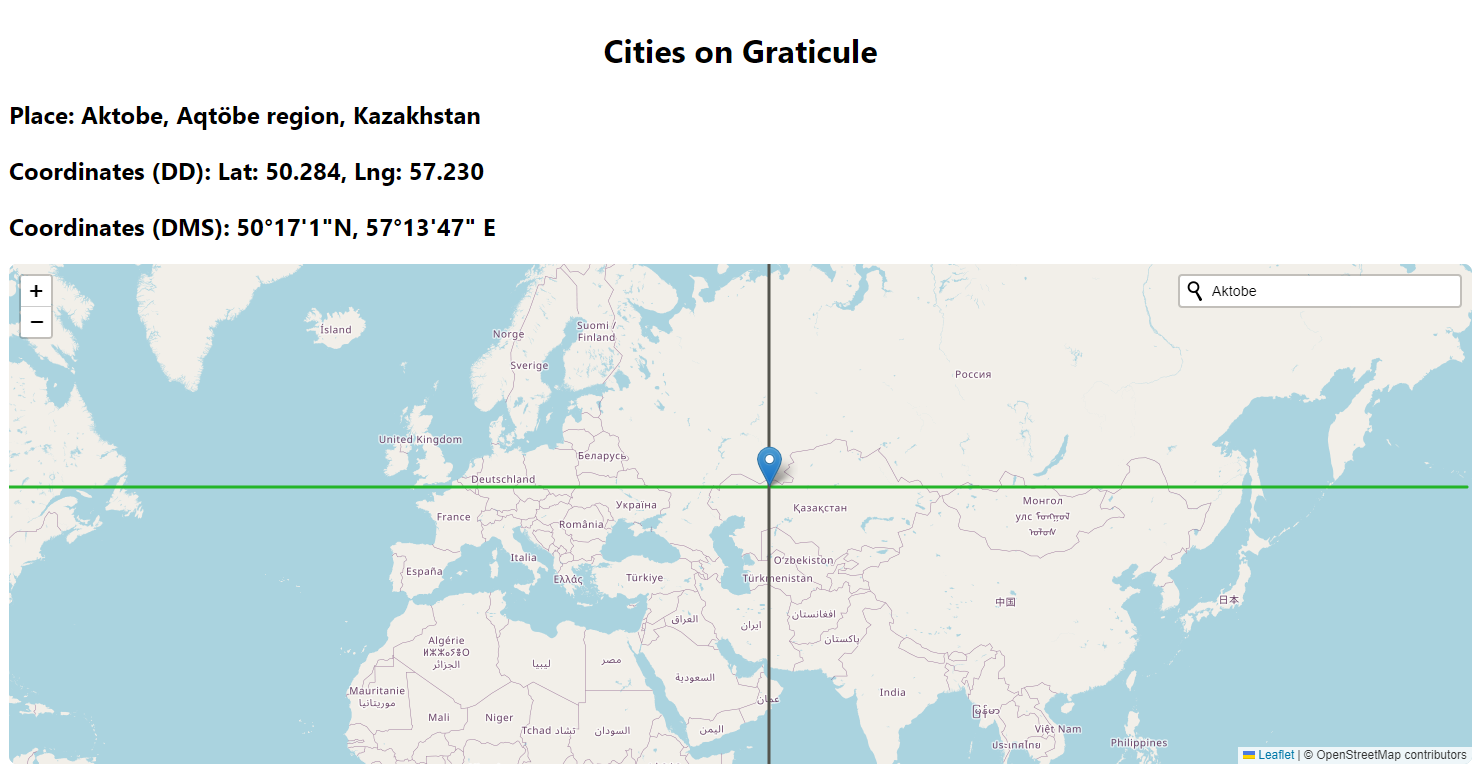
Points on graticule
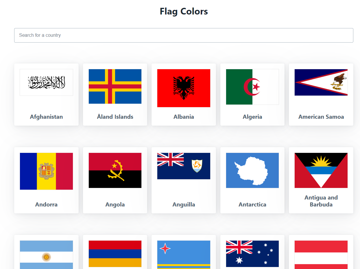
Flags colors
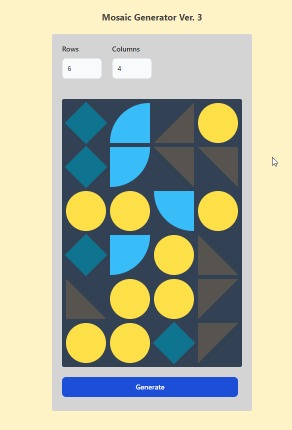
Mosaic generator
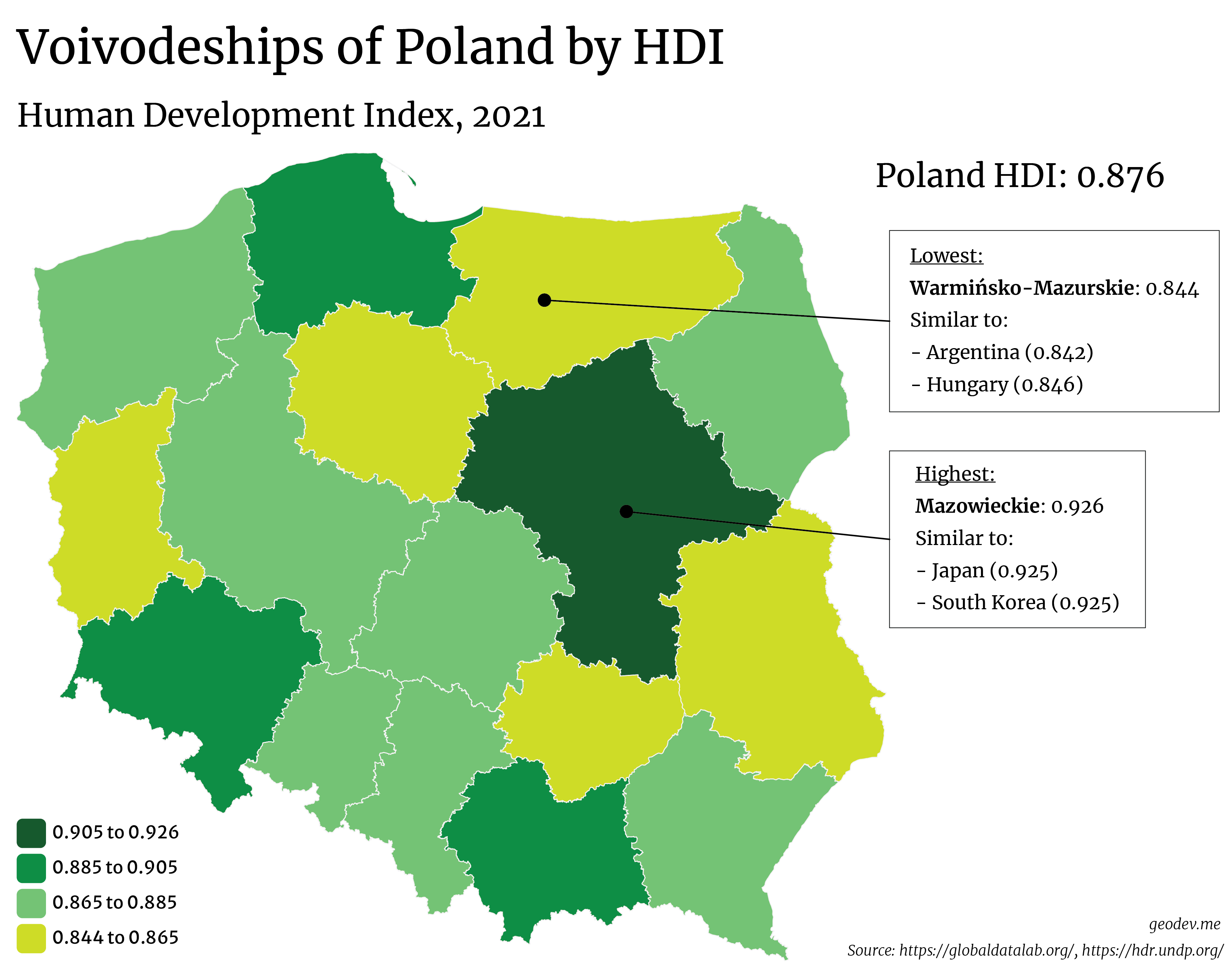
Socio-economic development in Poland
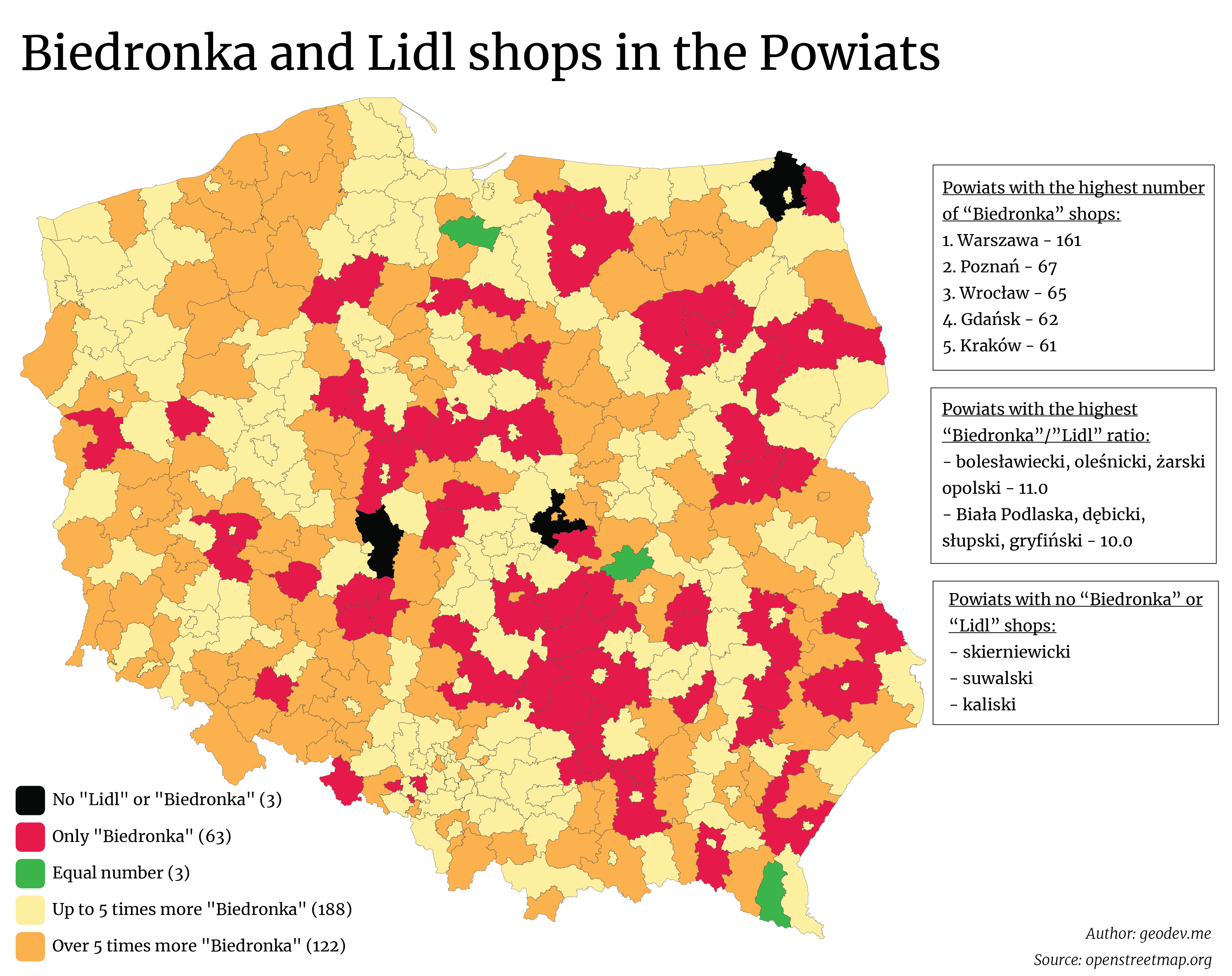
Ratio of largest discount shops chains in Poland
Places Names Finder
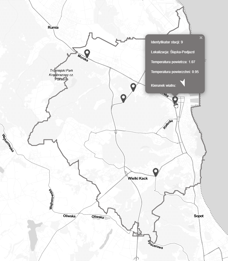
Gdynia Open Data
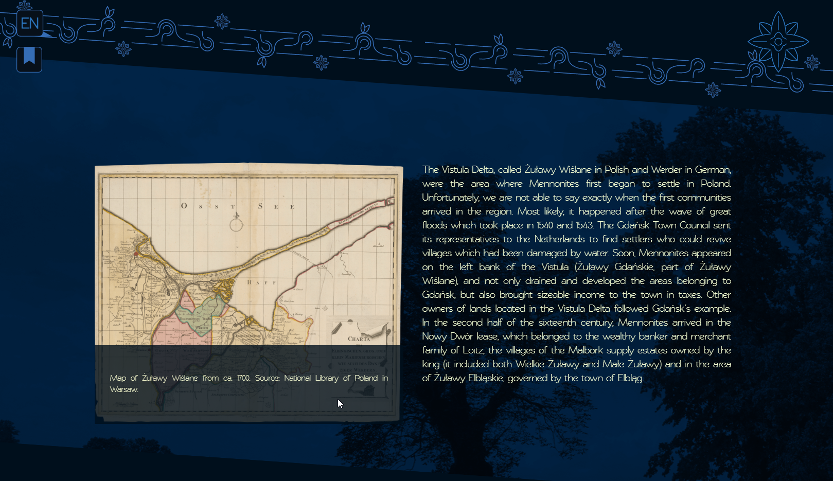
Mennonites in Poland website
Transnistria map
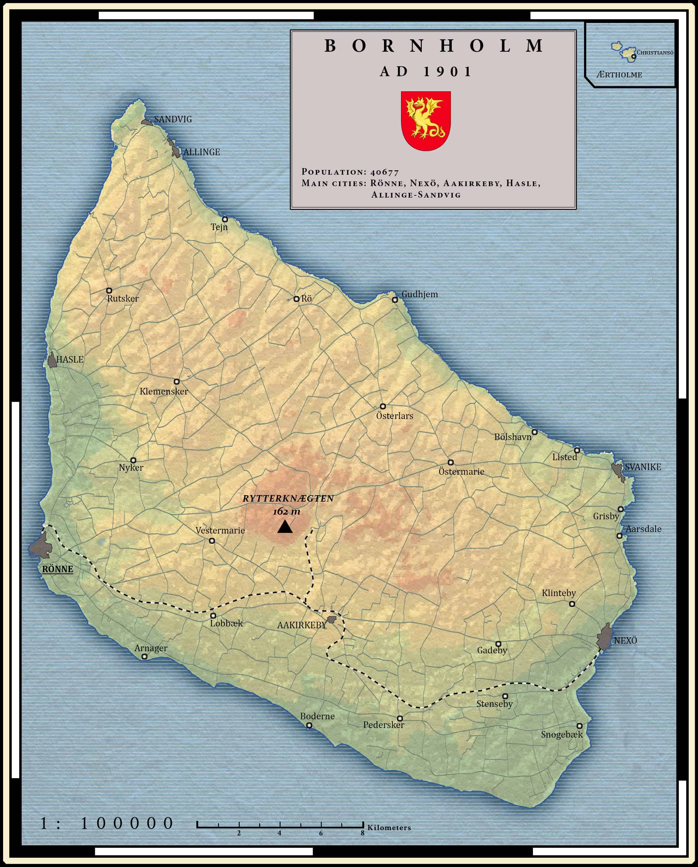
Map - Bornholm in 1901
Map for a historical publication
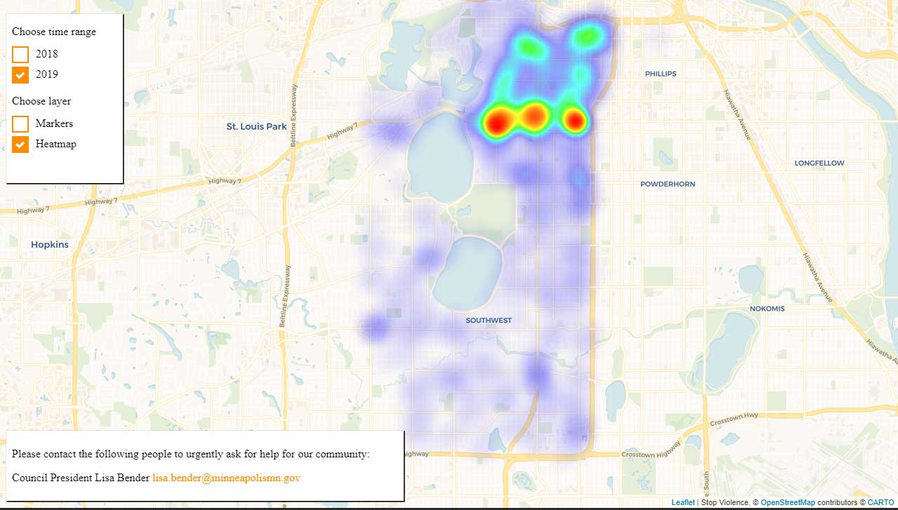
Violence map in Minneapolis
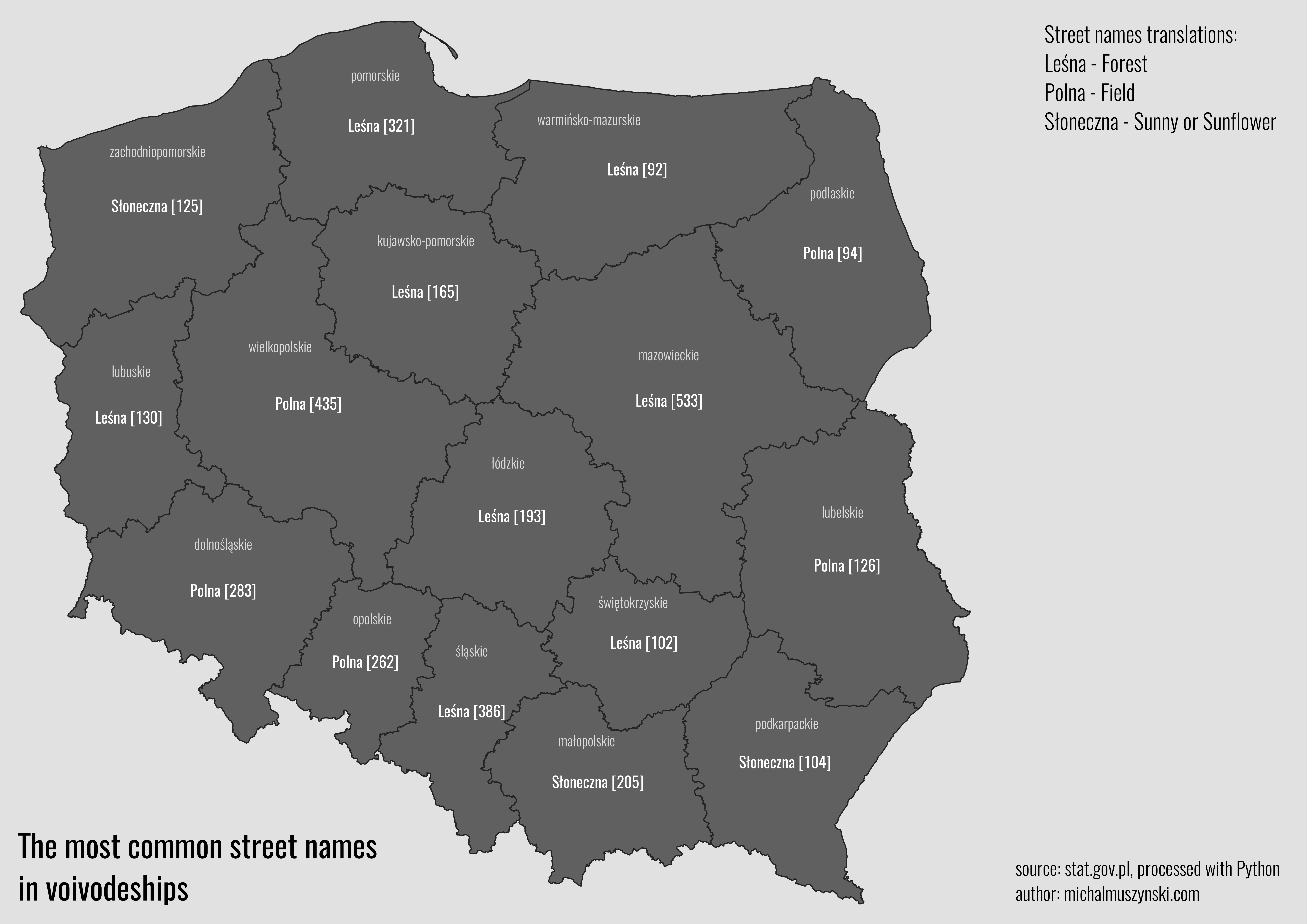
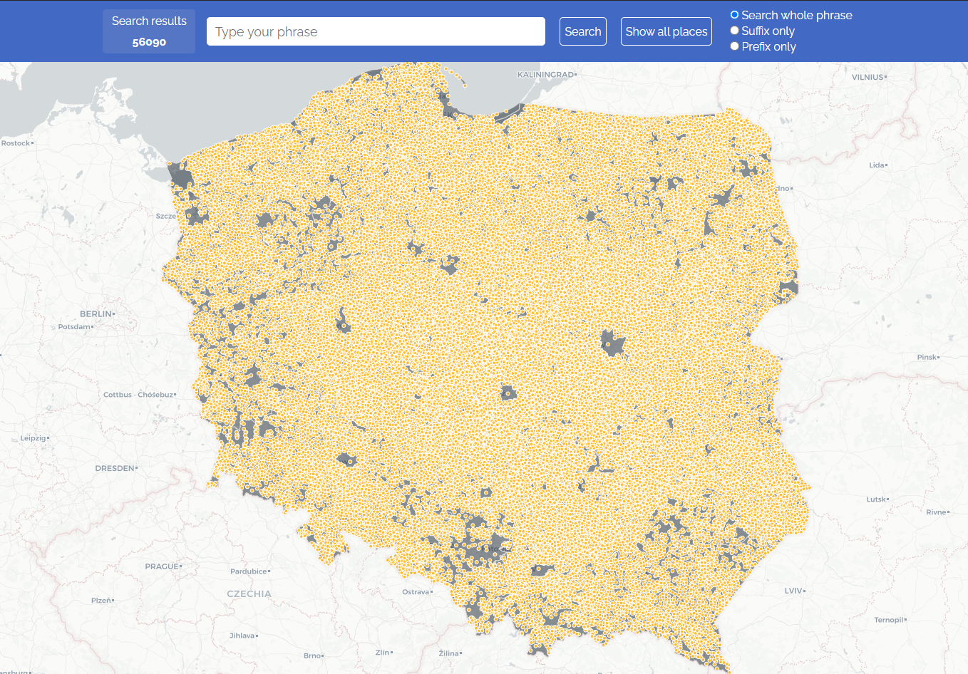
Street names in Poland
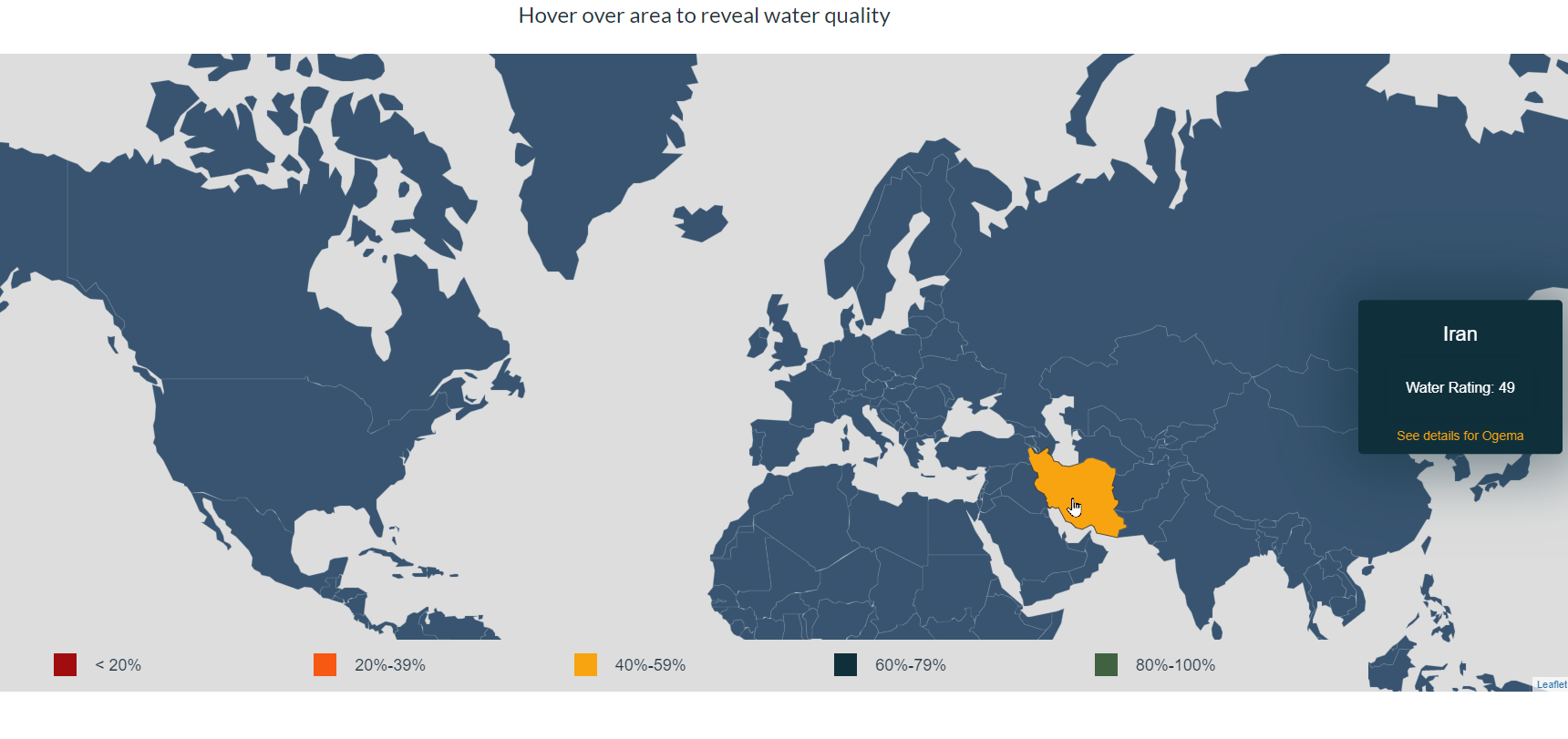
Tap Water Quality Interactive Map
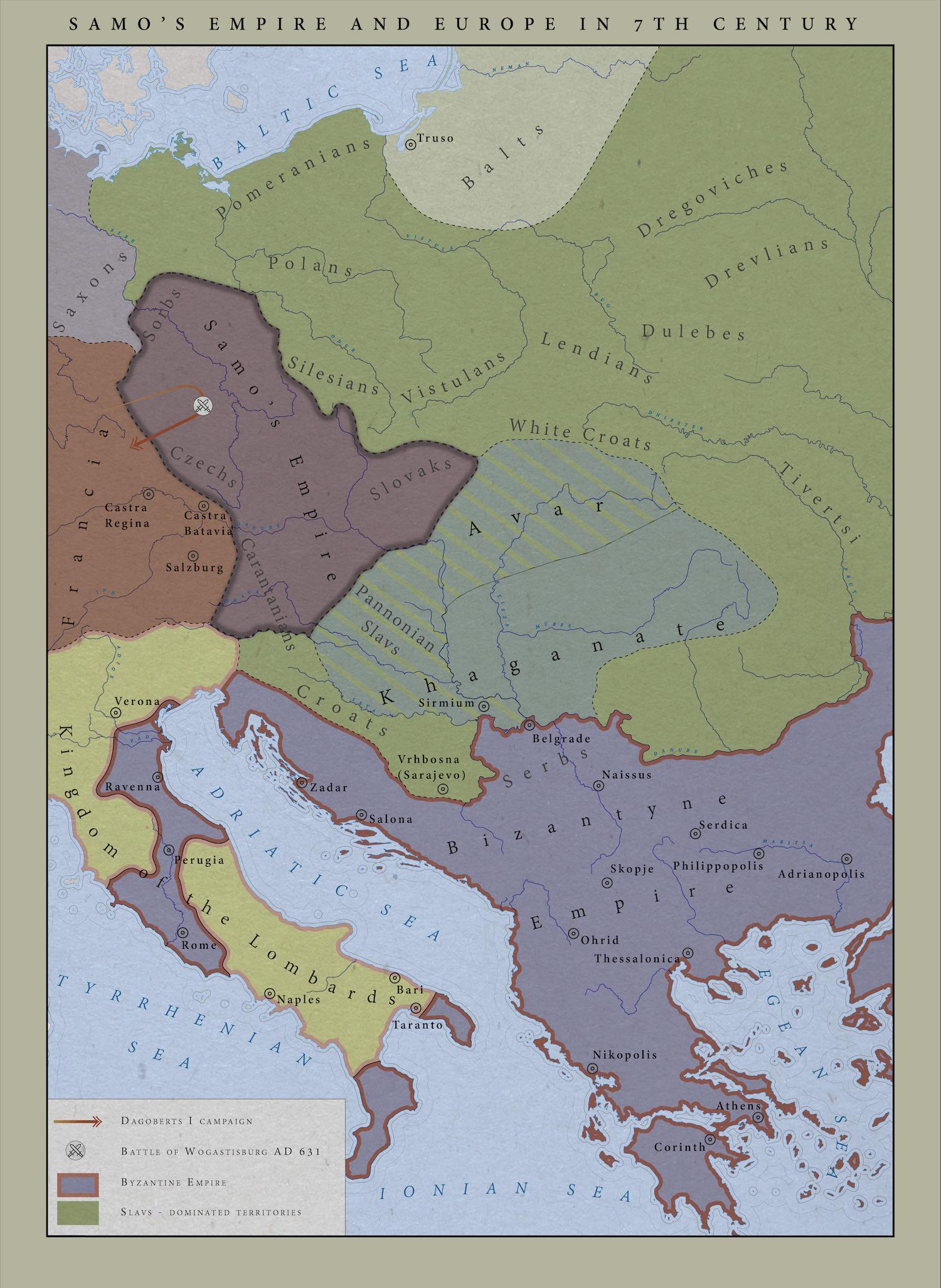
Samo's Empire Map
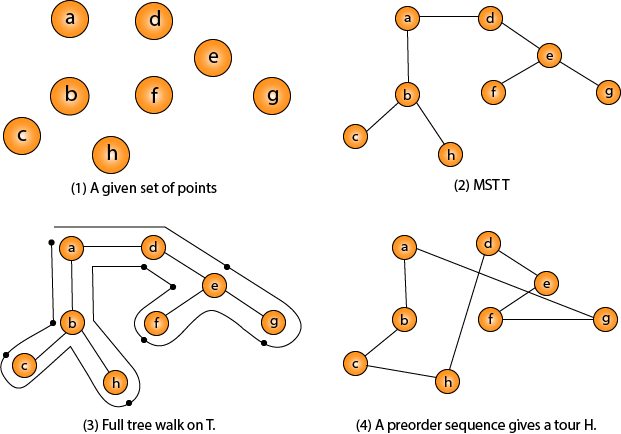
Traveling Salesman Problem Solver
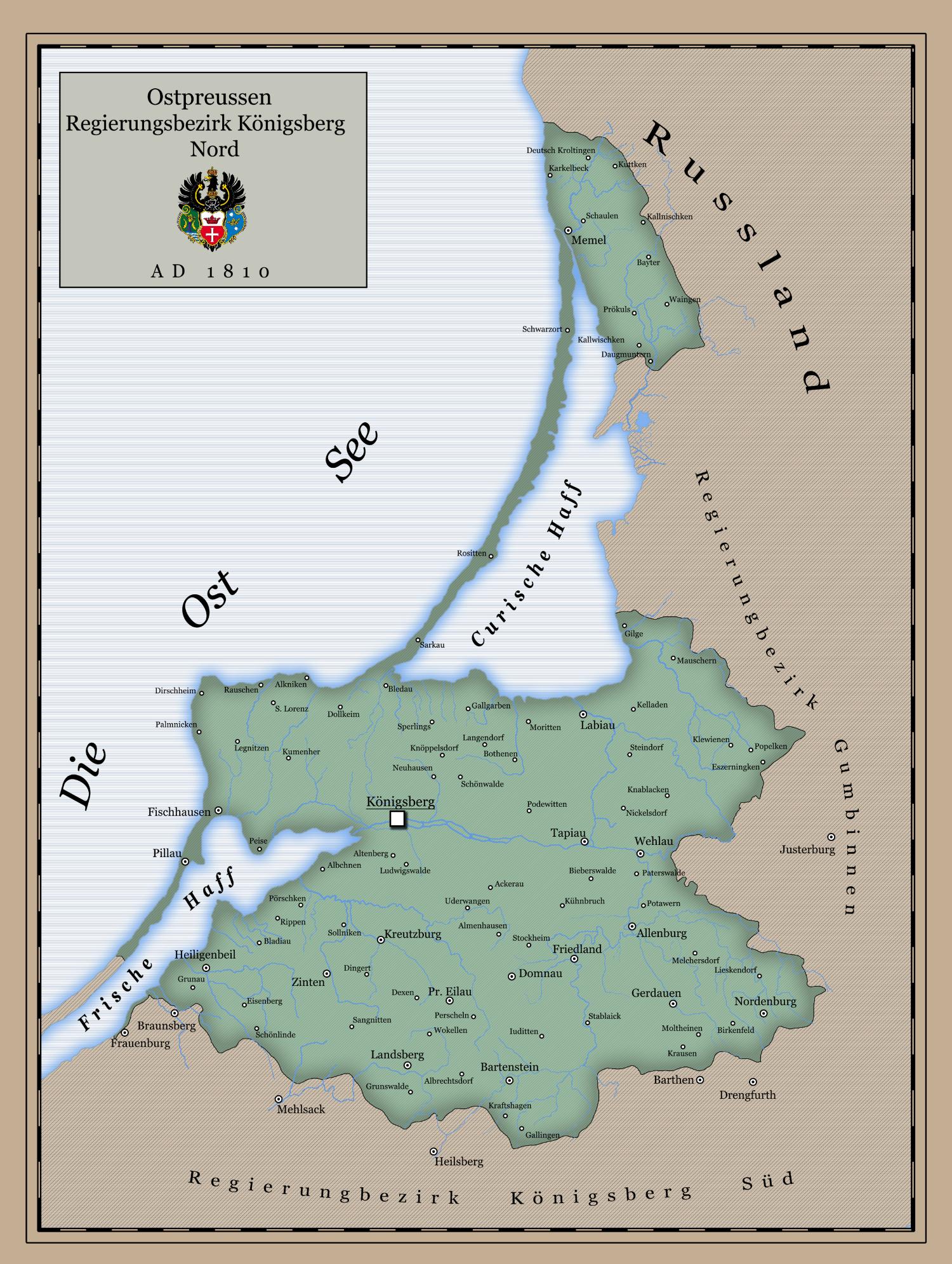
Map - East Prussia in 1810
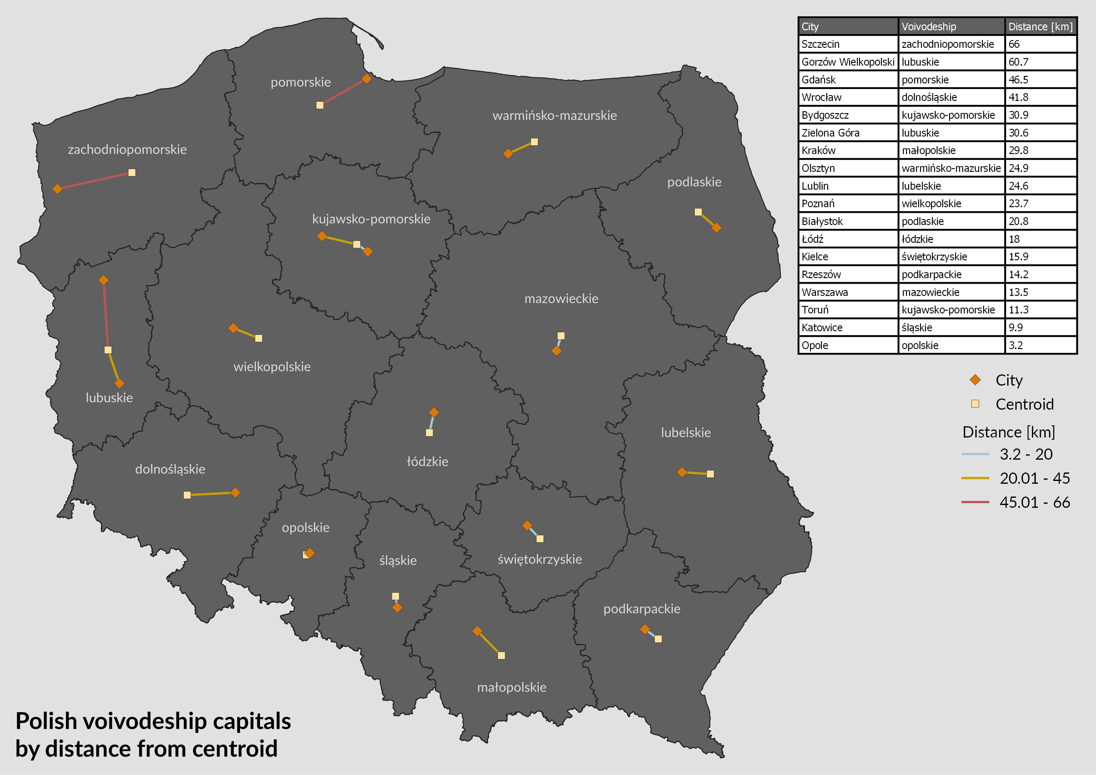
Voivodeships centroids